Advancing active mobility in greater Prince William, Virginia

Category: Transportation (Page 3 of 13)

Our Final Comments on the Northern Virginia Transportation Authority’s Six-Year Program Update

On July 11, 2022, Active Prince William joined 10 other advocacy organizations around Northern Virginia to send the following joint letter to the Northern Virginia Transportation Authority, three days before the Authority’s scheduled adoption of a two-year update to its Six-Year Program.


Coalition for Smarter Growth | Audubon Naturalist Society | Virginia Sierra Club |
Faith Alliance for Climate Solutions | Active Prince William | Sustainable Mobility for Arlington County |
Chesapeake Climate Action Network | Prince William Conservation Alliance |
Southern Environmental Law Center | YIMBYs of Northern Virginia |
Lewinsville Faith in Action

July 11, 2022

Honorable Phyllis Randall, Chair
Northern Virginia Transportation Authority
3040 Williams Drive, Suite 200
Fairfax, VA 22031

Re: Recommendations to further improve the proposed FY 22-27 Six-Year Program and process going forward

Chair Randall and NVTA board members:

The undersigned 11 organizations offer the following comments and recommendations that we urge you to adopt for the proposed FY 22-27 Six-Year Program coming before your vote this week.  In summary:

  1. We support the overall direction taken by the staff and committees in their selections from the candidate project list to fund all transit and most station access and local complete street projects;
  2. However, we remain concerned that the slate of projects recommended for funding – and the original candidate list – show a program still too focused on road expansion;
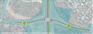
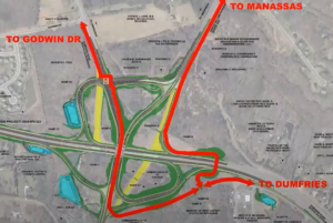
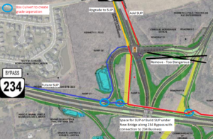
  3. We ask for important changes to the proposed FY 22-27 funding allocations in Prince William County: fund the Old Centreville Rd Widening project (PWC-035) as an alternative to the proposed destructive Rt 28 bypass (Alt. 2B) along Flat Branch;
  4. For the next 6-year program cycle, NVTA needs to ensure that local jurisdiction project submissions better reflect adopted regional policies for climate change and equity; and
  5. NVTA’s process for the Six-Year Program should facilitate meaningful public involvement from the start, including requiring public hearings prior to local government candidate project submissions.

These points are elaborated on the following pages.


1. We support the overall direction taken by the staff and committees in their selections from the candidate project list.

 We applaud the selection and funding of all of the transit projects and most of the station access, local street grid and complete streets projects.

 We appreciate that many of these changes reflect attention to public feedback you received and the importance of these projects for a more sustainable and equitable future.


2. However, we remain concerned that the slate of projects recommended for funding – and the original candidate list – show a program still too focused on road expansion.

65% of the candidate project funding requested was for highway and roadway capacity expansion.

55% of the staff recommended project funding is for highway and roadway capacity expansion.

These amounts are far too much given the other regional needs for safer streets, transit access, electrification, and climate resilience as well as improving our
transit, pedestrian and bicycle networks.

 This emphasis on road expansion also ignores the reality of induced demand, that widening roads is not a medium- or long-term solution for vehicle congestion, as shown in the Coalition for Smarter Growth’s On the Wrong Road in Northern Virginia report using the RMI Shift Calculator.


3. We ask for these important changes to the proposed FY 22-27 funding allocations in Prince William County:

Support a better, less destructive Route 28 project in Prince William County by funding the Old Centreville Road Widening project (PWC-035) as an alternative to the Route 28 bypass (Alternative 2B) along Flat Branch. The four-laning of Old Centreville Road combined with VDOT’s recommended Centreville Road/Route 28 STARS improvement package could effectively serve as a “Modified Alternative 4” for Route 28.

   This alternative project would avoid the adverse impacts to affordable homes in a low-income minority and immigrant community from the 28 Bypass project and would be compatible with walkable, transit-accessible economic development and neighborhood livability efforts in the existing Route 28 corridor.

To accommodate this project, shift funding from other NVTA recommended Prince William projects.


4. For the next Six-Year Program cycle, NVTA needs to ensure that local jurisdiction project submissions better reflect adopted regional policies

NVTA needs to require that local jurisdiction project submissions better reflect adopted regional policies to provide alternatives to driving and reduce car dependence, support transit-oriented land use, and achieve our equity and climate goals.

Equity in transportation, a core value of NVTA, must address the disproportionate impact of unsafe streets, proximity to traffic and pollution, and high personal transportation costs that auto-dependence causes for low- and moderate-income residents and workers. The Region Forward vision plan recognizes this in its goal to lower combined transportation and housing costs and to also improve access to travel options and allow more residents to live in walkable regional activity centers with good transit. These measures also reduce travel demand on roads and highways helping those who must commute or access important services by car. NVTA needs to ensure that its member jurisdictions consider who benefits and who is harmed by transportation projects.

The region’s Metropolitan Planning Organization, the National Capital Region Transportation Planning Board (TPB), just adopted a greenhouse gas reduction target of 50% for the on-road transportation sector. NVTA’s project selections should be tied to achieving those reductions. TPB’s climate change study showed that the region will need to reduce vehicle miles traveled of passenger vehicles by 15 to 20% below 2030 baseline forecasts, as well as rapidly adopt electric vehicles.

Tackling climate change in transportation also provides more travel options, greater proximity to jobs and services, lasting congestion management, and addresses inequities for households and workers regarding street safety, air quality, walkable amenities, personal transportation costs, housing options, and access to transit and job locations. With new car payments now over $700 per month and gas at $5 per gallon, the need in Northern Virginia for more walkable, bikeable, transit-friendly, mixed-use and compact communities with affordable housing is greater than ever.

Reducing per capita VMT – the need to drive for daily needs – by expanding transportation options, transit-oriented land use, and transportation demand management is also essential to meeting NVTA’s goal of reducing congestion.


5. NVTA’s process for the Six-Year Program should facilitate meaningful public involvement from the start, including local government candidate project submissions.

Since project priorities are advanced early on by local governments, NVTA must ensure that there are accessible public engagement opportunities early on.

NVTA should require that localities hold an advertised public hearing for NVTA project funding requests before the local governing body adopts its resolution of support for the application and before the projects are submitted to NVTA for funding consideration.

   Currently some jurisdictions generate staff reports and the elected body approves the project submissions as a consent agenda item with no public hearing.
   Public comments on proposed NVTA project submissions would be more  meaningful and help inform the local government before each set of projects is submitted to the NVTA for the Six-Year Program update.

In addition, NVTA coordinates the submissions for federal CMAQ and RSTP funds and for state SmartScale by Northern Virginia localities and should require similar transparency and public involvement before local governing bodies endorse those submissions.

Thank you for listening to stakeholders as you have carried out this process.

Sincerely,

Stewart Schwartz
Executive Director
Coalition for Smarter Growth
[email protected]

Renee Grebe
Northern Virginia Conservation Advocate
Audubon Naturalist Society
[email protected]

Douglas Stewart
Transportation Co-Chair
Virginia Sierra Club
[email protected]

Andrea McGimsey
Executive Director
Faith Alliance for Climate Solutions
[email protected]

Mark Scheufler & Allen Muchnick
Co-Chairs
Active Prince William
[email protected]

Chris Slatt
President
Sustainable Mobility for Arlington County
[email protected]

Zander Pellegrino
Northern Virginia Grassroots Organizer
Chesapeake Climate Action Network
[email protected]

Kim Hosen
Executive Director
Prince William Conservation Alliance
[email protected]

Morgan Butler
Senior Attorney
Southern Environmental Law Center
[email protected]

Luca Gattoni-Celli
Founder
YIMBYs of Northern Virginia
[email protected]

Jack Calhoun and John Clewett
Co-Chairs
Lewinsville Faith in Action
[email protected]

Our Input for the Route 234-Clover Hill Road Bowtie Intersection

2017 Concept for a Clover Hill Road/Prince William Parkway “Bowtie” Intersection

Recently, the Prince William County Department of Transportation asked for our feedback on their proposed preliminary design for rebuilding the intersection of the Prince William Parkway (Route 234) and Clover Hill Road near Manassas as an “innovative” bowtie intersection, where all direct left turns are eliminated and instead accommodated via two roundabouts on the minor cross street.   Our reply is posted below.   We will track this upcoming project in the coming years as the design is refined for construction.


Thank you for soliciting Active Prince William’s input on how the redesigned intersection of Clover Hill Road at the Prince William Parkway can best serve people walking and bicycling.

Conventional On-Road Bike Lanes Are Appropriate for Clover Hill Road

Clover Hill Road provides an important low-traffic bicycling connection between the City of Manassas (and adjacent residential neighborhoods within the County) and Manassas Regional Airport and points west, including the Broad Run VRE station and the new Route 28 shared-use path that now extends though Bristow all the way to Nokesville.  On the southwest side of Route 234, Clover Hill Road provides critical bicycling access to a network of low-traffic, bicycling-friendly roads within and near Manassas Regional Airport, including Harry J Parrish Blvd. Wakeman Drive, Observation Drive, Piper Lane, Residency Road, Pennsylvania Avenue, Carolina Drive, and Gateway Blvd.

As such, Clover Hill Road is eminently useful for bicycle commuting to employment sites within and near the airport, to the Broad Run VRE station, and to points west in Bristow.  In addition, Clover Hill Road and the low-traffic roads within and around the airport are used extensively for recreational bicycling on evenings and weekends.

Bicyclists on Bull Run Bicycle’s Tuesday evening shop ride wait to cross Route 234 at Clover Hill Road. To avoid hazardous right-turning traffic on both sides of this intersection, the group waits for a green traffic signal in the left travel lane of Clover Hill Road.

Both City of Manassas roadways that connect to this segment of Clover Hill Road–i.e.. Clover Hill Road from Godwin Drive to Wellington Road and Godwin Drive from Clover Hill Road to Hastings Drive–already have conventional on-road bike lanes.  Thus, in addition to including sidewalks for pedestrians, the entire redesigned segment of Clover Hill Road should include conventional on-road bike lanes in both directions.

Note that VDOT’s website that describes bowtie intersections includes conventional on-road bike lanes on all four legs of that intersection (see the illustration copied below).

Since, as in the above illustration, the proposed design features dedicated right-turn-only lanes on Clover Hill Road at both approaches to the Prince William Parkway, it would be vital to install the bike lanes at both approaches to the Prince William Parkway between the straight-through travel lane on the left and the right-turn-only lane at the curb.

Within the roundabouts, the bike lanes–if any–should be on the far right and could be buffered or physically separated from roadway traffic.  Alternatively, especially if right-of-way is constrained at the roundabouts, the bike lanes could be discontinued within the roundabouts and bicyclists encouraged to navigate the roundabouts as either a driver centered within the travel lane or (using strategically placed curb ramps for access and egress) as a pedestrian using the sidewalk.

However, upon exiting each roundabout, right-turning motorists should be directed to yield to any bicycle traffic ahead and to carefully merge right across the continued bike lane to enter the emerging right-turn-only lane before reaching either the Parkway (along both southbound and northbound Clover Hill Road) or Godwin Drive (along northbound Clover Hill Road).

Please note that these same conflicts between right-turning motorists and straight-through bicyclists presently exist at the current Clover Hill Road/Route 234 Intersection in the absence of any bike lanes and that appropriate traffic engineering measures, involving pavement markings and signage, can optimize the safety of all road users.

Design This Intersection to Safely Accommodate the Future Shared-Use Path Along Route 234

Although this project won’t construct the long-planned missing shared-use path along Route 234, the design of this intersection should not preclude its future construction and should also ensure that pedestrians and bicyclists using that shared-use path can cross Clover Hill Road safely.  As a designated segment of the National Capital Trail Network, a continuous, high-quality shared-use path along Route 234 should be a priority for Prince William County.

Unobstructed right-of-way should be acquired and preserved as part of this project to accommodate the future Route 234 shared-use path, and the project design should ensure that the route and future design of this path would not be blocked or compromised by noise barriers, above-ground or buried utilities, or roadside signage, traffic signals, or street lighting.  Until the county decides whether this path will be constructed on the northeast or southwest side of Route 234, right-of-way should be reserved for the future shared-use path on both sides.

In addition, the intersection design should ensure that the future Route 234 Trail will have a safe, at-grade crossing of Clover Hill Road, presumably coordinated with the same traffic signal that regulates the Route 234 traffic.

Eliminate High-Speed Right-on-Red Turning Movements from Route 234 onto Clover Hill Road

Unlike VDOT’s model bowtie intersection illustrated above, the currently proposed intersection design incorporates two free-flowing, high-speed, right-turning movements, using pork-chop islands, for Route 234 traffic to enter Clover Hill Road.  We believe this currently proposed design feature would seriously endanger both 1) bicyclists and pedestrians crossing Route 234 at Clover Hill Road and 2) the users of the future Route 234 Trail crossing Clover Hill Road.

Vulnerable, non-motorized road and trail users who are crossing either roadway on a green traffic signal should not be endangered by high-speed traffic that is simultaneously turning right-on-red at near-freeway speeds at these pork-chop islands.  While a decision to completely ban all right-turn-on-red movements at this intersection might best be made by expert traffic engineers, we firmly believe that free-flowing right-on-red movements would be dangerous at this intersection and should not be promoted by design features such as pork-chop islands.

Instead, vehicle traffic entering Clover Hill Road from Route 234 should be encouraged to slow to the 25 MPH posted speed and carefully merge into the single travel lane approaching the roundabout, while bicyclists who have just crossed Route 234 on a green signal must merge into the bike lane at the right edge of the roadway.

Again, careful pavement marking and signing would help all road users safely negotiate these conflicts, whereas a design that promotes high-speed right-on-red vehicle traffic would endanger vulnerable road users.

Bicyclists and pedestrians crossing Route 234 at Clover Hill Road on a green traffic signal would primarily be endangered by motorists turning right-on-red from Route 234 at the far side of their crossing.  By contrast, users of the future Route 234 Trail crossing Clover Hill Road on a green traffic signal could encounter both motorists turning right-on-green from Route 234 as well as motorists turning right-on-red from Clover Hill Road.   All such right-turning movements would be safer if the design encourages motorists to slow or stop completely before entering a crosswalk and turning into the path of vulnerable road users.  Partial traffic signal phasing, such as leading pedestrian intervals, could also make these crossings safer.

Clover Hill Road is a local street posted for 25 MPH, and there is no compelling need to promote free-flowing right-turn-on-red vehicle movements onto Clover Hill Road.

The 2019 AADT for all connected local roadways (i.e., Clover Hill Road, Godwin Drive, and Harry J Parrish Blvd) ranges from 2100 to 4700, so Clover Hill Road only needs one travel lane per direction between intersections. The proposed design includes a grassy median along Clover Hill Road, but there’s no compelling need for a grassy median on a road posted for 25 MPH, and that grassy median is about a full-lane wide on the segment approaching Godwin Dr.

Active Prince William also supports the inclusion of a shared-use path along this entire segment of Clover Hill Road; however, such a path would not connect to any existing path along Clover Hill Road, Godwin Drive or Harry J. Parrish Blvd, and it appears that the long-planned path along the Route 234 Bypass won’t be built for the foreseeable future.  Thus, a shared-use path seems less essential, especially on the airport side of Route 234, provided that both sides of Clover Hill Road will have sidewalks and bike lanes.

If spatial or terrain constraints would otherwise preclude the addition of both on-road bike lanes and sidewalks along Clover Hill Road in both directions, consideration should be given to narrowing or eliminating the grassy medians.

Thank you for considering our input.

###

Our Comments on the Mathis Avenue Improvement Project

On March 31, 2022, Active Prince William submitted the following comments to the City of Manassas regarding its proposed Mathis Avenue Improvement Project:


Re: Mathis Avenue Improvement Project (T-086) Public Meeting Comments

On behalf of Active Prince William, I’m writing to submit the following comments in response to the March 17, public meeting for the above-referenced project.  Our all-volunteer organization seeks improved active mobility and public transportation throughout greater Prince William, to create more livable, equitable, and sustainable communities.

An Improved Public Process for Transportation Project Development

We sincerely appreciate the improved process used to involve the public at the 30% design stage for this capital transportation project, which included both a February 23 virtual public meeting and an in-person meeting held on March 17.  This public involvement process is far better than the one used by City staff for its recent Sudley Road Third Lane Project, which excluded all public input before preliminary engineering was at least 90% complete (including when that project had been re-scoped substantially twice, in December 2017 and in February 2021).  We hope this public comment opportunity reflects a permanent policy change to proactively involve the public in all City transportation projects going forward, ideally starting at the project scoping stage.

The Proposed Design is a Reasonable Interim Aesthetic Improvement but Lacks Essential Pedestrian Amenities for a Vibrant, Mixed-Use Street

As a final condition for a revitalized Mathis Avenue as a mixed-use, pedestrian-oriented street–ideally with robust bus transit service–the proposed design would be a major disappointment.  However, as an interim improvement intended to transform the appearance of this somewhat desolate commercial street and to promote future mixed-use redevelopment at minimal cost, this project does appear to have merit.

In particular, the proposed design provides sidewalks that are too narrow for comfortable two-way walking, are too close to the roadway, and lack street trees and pedestrian-serving street furniture in what should be much wider curbside planting strips and furniture zones.   In addition, the sidewalks are interrupted with frequent curb cuts, where motor vehicle cross flows impede safe and comfortable walking.

However, considering the need for Mathis Avenue to continue serving the existing auto-oriented businesses beside it, especially along the east side of this street, until redevelopment occurs some years in the future, the imperative to minimize right of way takings and to preserve the existing curb cuts is understandable.

To effectively promote the specific forms of redevelopment that the City seeks and to ensure that this redevelopment incorporates the necessary mobility infrastructure to equitably support that redevelopment, the City’s Department of Planning and Community Development should undertake a robust community-based planning process to develop a detailed form-based zoning code for the Mathis Avenue corridor.  Form-base zoning codes are a proven tool to effectively promote the specific forms of redevelopment desired by localities.

Bicycling Accommodations and Roadway Design Speed

The lack of bike lanes (or any alternative bicycle facilities) in this project is disappointing but is also understandable since the existing curbs are not being moved to keep the existing storm sewer infrastructure in place, to minimize costs and commercial property impacts.  However, without bike lanes, the construction of raised medians will degrade bicycling conditions substantially, and those degraded conditions are unlikely to be remedied by a future roadway widening when the corridor is eventually redeveloped.

Presently, motorists can readily safely overtake people riding bicycles on Mathis Avenue by passing in the two-way central left-turn lane.  The raised medians, however, will prevent motorists from overtaking bicycle riders, who typically travel at 10-16 MPH.  Thus, people riding bicycles on Mathis Avenue will serve as slow-moving traffic-calming devices.  This roadway change will make bicycling unpleasant for nearly all riders and will subject people riding bicycles to increased harassment from frustrated motorists who are unable to pass.  Moreover, since Mathis Avenue would probably not be rebuilt with added bike lanes when redevelopment occurs in the future, this degradation of bicycling conditions on Mathis Avenue is likely permanent.

The fact that nearby Portner Avenue is designated as a bicycle route is no reason to degrade bicycling conditions on Mathis Avenue.  While many through bicyclists already prefer to travel on Portner Avenue, only Mathis Avenue serves the businesses and jobs located along Mathis Avenue, and people will someday live on this segment of Mathis Avenue too.

Thus, for both bicycle access and pedestrian safety, this project should strive to reduce the design speed for Mathis Avenue–and ideally the posted speed limit–to 20 MPH or below.   The raised median with street trees—and especially street trees in future curbside planting strips and future taller buildings closer to the roadway—should encourage motorists to drive more slowly on Mathis Avenue, but other design changes are needed too.

Shorter curb-return radii at corners and narrower sidewalk curb cuts would help reduce motor vehicle speeds, and electronic speed-feedback signs paired with posted speed limit signs (dynamic speed displays) would warn speeding motorists to slow down.  In addition, shared-lane markings (aka “sharrows”) centered in each travel lane would inform both motorists and bicycle riders that this is a shared roadway.

More Visible and Shorter Crosswalks

One notable design feature that should be changed is the proposed use of brick-colored stamped asphalt crosswalks.  While intended to impart historic charm, brown-colored crosswalks are far less conspicuous to motorists than modern high-visibility and reflective thermoplastic crosswalk markings.  The primary purpose of marked crosswalks is to alert motorists to the likely presence of crossing pedestrians, encouraging drivers to slow down, look for, prepare to yield to, and stop for pedestrians who may be crossing the roadway.  A faux-brick aesthetic is far less important than the safety of people who are walking across the street.

In addition, the final design of each intersection should pay particular attention to shortening the length of all crosswalks to the extent feasible and to install two separate curb ramps for the crosswalk landings at each corner.  The present design includes a single combined curb ramp at the southeast corner of Mathis Avenue and Sudley Road and at all four corners of Mathis Avenue and Liberia Avenue, the two on the north side not being rebuilt.

Designing shorter curb-return radii at all intersection corners, as suggested above to reduce the roadway design speed, would also reduce the crosswalk lengths at those intersections.

Consider Short Left-Turn Lanes at Reb Yank Drive and Carriage Lane

The advertised design does not include any space in the center of the roadway (beyond the intersection itself) to store vehicles waiting to turn left at Reb Yank Drive (from both directions) or southbound at Carriage Lane.  While shortening the raised medians to add short left-turn pockets at those three locations could increase travel speeds along Mathis Avenue and could also remove the proposed median refuges for crossing pedestrians at those unsignalized intersections, it may be prudent to add those left-turn pockets to smooth traffic flow, reduce traffic congestion, and lower the incidence of rear-end collisions at those locations.  However, if traffic studies have already documented that those left-turn pockets are unnecessary, then please retain them.

Thank you for considering our comments as you finalize the design of this project.

While Better, the Revised Design of the Route 234-Brentsville Road Interchange in Still Badly Flawed

Prince William County DOT’s currently proposed circuitous trail routing through the Interchange, assuming that a direct trail bridge connecting the existing Route 294 and Route 234 Trails is included in this project

Our proposed trail connections through the planned interchange to reach Route 234 Business (red line) and the future trail along the Route 234 Bypass (blue line).  A trail (red line) running along the north side of Route 234 would pass underneath both new roadway overpasses. The three light blue circles show where box culverts could allow the trail to be routed beneath highway ramps.  The areas shown in yellow are existing roadways that are planned to be removed.  This design eliminates all at-grade trail-roadway crossings, except to reach Route 234 Business.  However, by building a shared-use path along the west side of Route 234 Business (connecting to Godwin Dr), trail users would be required to cross only 5-lanes of stopped traffic at just the western leg of the signalized intersection of Bradley Cemetery Way and Route 234 Business, not 12-lanes of stopped traffic plus one lane of free-flowing right-turning traffic at two separate legs of that intersection.

This post follows up on the comments we previously submitted in response to the December 8, 2021 Design Public Hearing for Prince William County DOT’s Route 234-Brentsville Road Interchange Project.

On March 18, 2022, the County released this followup video presentation on the proposed project design.   County DOT staff are willing to at least partly addresses three concerns with the proposed trail connections that were raised at the Design Public Hearing:

1) In response to public comments from Active Prince William and others, the County is now studying the cost feasibility of a new, dedicated trail bridge over Rte 234, just east of the interchange, to directly connect the existing trails along Route 234 and Route 294.   If this trail bridge can be added without the project exceeding it’s $55 million budget, it will be included in this project.   Otherwise, it probably won’t.

2) In response to safety concerns raised by many about the four proposed closely spaced at-grade trail crossings of free-flowing highway ramps near Route 294 and Bradley Cemetery Way in the northeast corner of this project, those hazardous at-grade trail crossings may not be built, at least if the added trail bridge discussed above is actually built.    However, this change would produce a long, circuitous trail route between the western legs (Route 234 Bypass and Route 234 Business) and eastern legs (the existing trails along Routes 234 and 294) of this interchange (shown in the top image above).

3) In response to objections that the design completely omits the long-planned trail along the Route 234 Bypass that should join the existing trails along Route 234 and Route 294,  the design team has identified a future location for this trail along the northwestern edge of the interchange (see the blue line in the second image above).

However, all trail connections to and from Route 234 Business and the long-planned future trail along the Route 234 Bypass (aka Route 234 North) would still require a two-stage at-grade crossing of 12 signalized traffic lanes plus one free-flowing right-turn lane at the rebuilt intersection of Bradley Cemetery Way and Rte 234 Business plus a second at-grade trail crossing of a free-flowing highway ramp at the south side of the interchange (at the on-ramp from Brentsville Road) .  Those remaining design flaws would still create considerable delays and hazards for trail users.

Under Prince William DOT’s revised design for this interchange, this slow and hazardous crossing of 13 traffic lanes at two legs of the signalized intersection of Bradley Cemetery Way and Route 234 Business would remain.  All trail access and egress from either Route 234 Business or the future trail along the Route 234 Bypass would need to use this routing to join either of the existing trails along Route 234 and Route 294 or Brentsville Road.

As a followup proposal, we suggest routing the long-planned trail along the Route 234 Bypass along the north side of Route 234 (per the second image from the top), connecting that trail to both the existing Route 294 Trail to the east and to a new shared-use path along the west side of Route 234 Business (where the existing pavement, depicted in yellow, is planned for removal).   This trail (depicted with a red line in that image) would pass underneath both new roadway overpasses being built to carry Brentsville Road and Route 294 over Route 234 and could also pass underneath three single-lane interchange ramps inside box culverts (see the light blue circles).

Under our proposal, the long-planned trail along the Route 234 Bypass would run along the north side of Route 234 and pass under both planned roadway bridges.


Three short box culverts could be used to route our proposed trail along the north side of the Route 234 Bypass beneath three one-lane interchange ramps.  Only one such box culvert would be needed for the connection to Route 234 Business.

Our proposed design eliminates all at-grade trail-roadway crossings, except to reach Route 234 Business.  However, by building a shared-use path along the west side of Route 234 Business (connecting to Godwin Dr), where only a sidewalk is currently planned, trail users would be required to cross only 5-lanes of stopped traffic at just the western leg of the signalized intersection of Bradley Cemetery Way and Route 234 Business, not 12-lanes of stopped traffic plus one lane of free-flowing right-turning traffic at two separate legs of that intersection.

Our proposal could also lower the cost of this project by eliminating the need to include a 14-foot wide shared-use path on the proposed Brentsville Road bridge.

Active Prince William believes that first-class, safe and direct trail connections for all five legs of this interchange can and should be provided within this project’s existing budget of $55 million.

« Older posts Newer posts »