Advancing active mobility in greater Prince William, Virginia

Category: Bike Trails (Page 5 of 5)

Learn How to Help Make Prince William and Manassas More Bicycle Friendly

Are you interested in learning how to help make Prince William County and Manassas more bike-friendly? Would you like be a more effective advocate? Fairfax Alliance for Better Bicycling (FABB) have opened up their FREE Bicycle Advocacy Workshop to be held on Saturday, Feb 4, 2017 to interested residents from Prince William County.

FABB Bicycling Advocacy Training

FABB Bicycling Advocacy Training

Bicycle Advocacy Workshop
Saturday, February 4, 2017
9:30 a.m. to 3 p.m.
Prince of Peace Lutheran Church
8304 Old Keene Mill Road, Springfield

On February 4th, the Fairfax Alliance for Better Bicycling is a offering an advocacy workshop to provide you the basic tools and strategies needed to help make bicycling better in your community. Learn how to build a successful advocacy plan, identify key local decisionmakers, and familiarize yourself with helpful online advocacy tools. There is no charge for the workshop, but participants are asked to pre-register by January 29, 2017.

Workshop presenters are local citizens with a proven record of leading advocacy campaigns including FABB members Sonya Breehey, Bruce Wright, and Alan Young, and Fionnuala Quinn of The Bureau of Good Roads. Hunter Mill District Supervisor Catherine Hudgins will also be joining us.

Fairfax Alliance for Better Bicycling

Fairfax Alliance for Better Bicycling

Route 234 Trail to be Extended

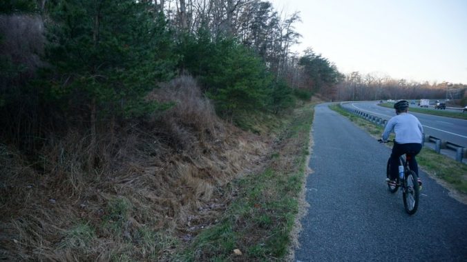
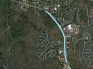
The Route 234, Dumfries Rd, bicycle and running trail is set to be extended from its current Eastern end point at Golf Club Dr, the main entrance to Montclair. The project will extend the trail for more than an additional mile, past the Brittany Residential Community down to Talon Dr just past the 7-Eleven. The trail extension will link Montclair, Brittany, and Four Seasons communities to Fortuna Plaza enabling thousands of people to bike and walk to shopping and restaurants that are currently accessible only by car.

Route 234 Trail Extension Map

Route 234 Trail Extension Map

The project will expand options for outdoor activities in the area, connect more people to the unofficial North entrance to Prince William Forest Park (near Waterway Dr), and improve access to a number of PRTC bus stops along Route 234, making it safer to walk or bike to transit in this area of the county.

Construction of the Route 234 trail extension should begin next year and is planned to be completed by Spring of 2018.

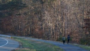
Route 234 Trail Runners

Route 234 Trail Runners

Future Plans.

Prince William County DOT has plans for a future extension that will complete the trail all the way to Route 1, Jefferson Davis Highway. The completion of the trail to Route 1 is not yet funded, but PWC DOT has worked with the regional Transportation Planning Board (TPB) to get the project on the unfunded pedestrian and bicycle priority projects list to receive funding as soon as it is available.

The Google Map below shows the new trail section being constructed (in purple), and existing sections of the trail (in green). Lines in red in the map are future potential projects.

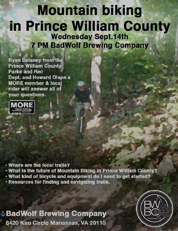
Mountain Biking in Prince William County Happy Hour – Bad Wolf Brewing, Wed 14 Sept 2016 7:00 PM

Do you want to ride off-road in Prince William County?

Conway Robinson State Forest

Conway Robinson State Forest

Here’s an opportunity to learn more about where to ride, what is happening with mountain biking in Prince William County, and enjoy some beer from a local brewery.

Mountain Biking in Prince William County Happy Hour

Questions and Answers with:
  • Ryan Delaney (of PWC Parks Dept)
  • Howard Olsen, a MORE member and local rider
Bad Wolf Brewing, 8420 Kao Circle, Manassas, VA 20110
Wednesday, September 14 7:00 PM.

For additional information about MORE (Mid-Atlantic Off-Road Enthusiasts): MORE Website

Click Map to view
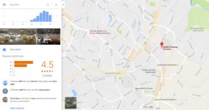
Bad Wolf Brewing Map

Google Map of Bad Wolf Brewing

Bad Wolf Brewing

Bad Wolf Brewing

Moutain Biking in Prince William County Happy Hour

How to Submit a Request to Clear Debris from Sidewalks and Trails

If you walk or bike with any frequency in Northern Virginia, I am sure that you have encountered sand, dirt, gravel, grit, broken glass, etc. covering sidewalks and bike trails along our roadways. VDOT has a website for residents to submit service requests that takes only a few minutes to complete. The process is outlined below.
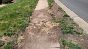
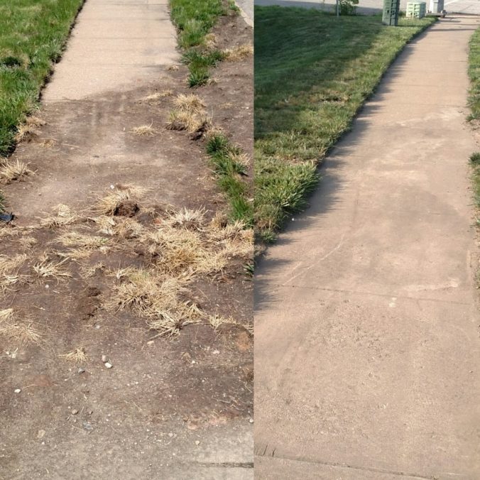
Debris on sidewalk before request was submitted

Photo of debris blocking sidewalk along Old Bridge Rd across from the Old Bridge/Rt 123 Commuter Parking Lot
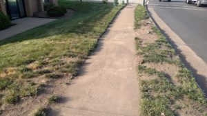
Sidewalk after clearing by VDOT

Sidewalk after clearing by VDOT within 24 hours of submitted request.

Most roadways and their associated sidewalks and shared-use paths in Northern Virginia are managed by the Virginia Dept of Transportation (VDOT). Exceptions to this rule are where roads are privately owned, such as in some Home Owners Associations, and in some cities, towns, and Counties (such as Arlington County). Most roads in Fairfax and Prince William Counties are owned and maintained by VDOT, not the County governments; therefore, requests to fix problems on the roadways and their associated sidewalks and shared-use paths need to be directed to VDOT on their My VDOT website.

Much of the sand, gravel, grit and debris on our roadsides, curbs, sidewalks, and shared-use paths is left over from the heavy salting, sanding, and plowing that occurred back in January. VDOT does not have a scheduled maintenance program for clearing debris, but they do respond to resident’s requests.

You can easily submit a request on-line for VDOT to clear debris from specific areas that you identify. We recommend that you take a photo of the issue that you want addressed, then visit the My VDOT website.

1. Select the Type of Request
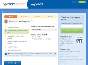
My VDOT Service Request

My VDOT Service Request Initial Page

On the My VDOT website, select “I need something removed from a road”, then on the right, under “What do you need removed?”, select “Remove debris”, then below that, under “Where is it located?” select “On the shoulder or in the ditch”. Once you have done this, click the Continue button.

2. Enter the Location
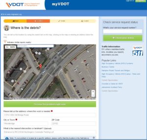
My VDOT Service Request

My VDOT Service Request Location Page

On the Location page, you will enter information about where the debris needs removal from. You can either zoom in on the map and click the location to drop a pin, or you can enter an address.  Once you have provided an accurate location, click the Continue button.

3. Add Details and a Photo

My VDOT Service Request

My VDOT Service Request Details Page

On the Details page enter any other information VDOT maintenance crews should know about the issue, such as details about the debris, or if it is blocking or impeding use of the road/sidewalk/trail. Enter a description, and be sure to mention if the debris needs clearing from a sidewalk or trail (shared-use path). Under the “Do you have an image or file to share?” section click the Choose File button to add the photo that you took of the debris, then click the Continue button.

4. Enter Contact Information

On the last page, enter your name and email address, and check the boxes if you want to be notified about status updates or create an account (both optional). You can receive status updates via email or text messages (if you provide a mobile phone number).
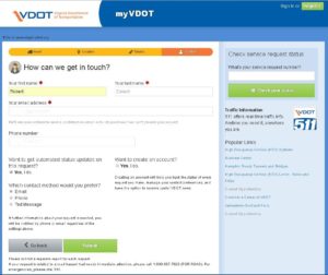
My VDOT Service Request

My VDOT Service Request Contact Page

You can also check the status of your submitted service requests by returning to the MyVDOT website and logging on if you created an account, or by entering a service request number.
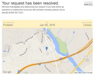
MyVDOT Service Request Status

MyVDOT Service Request Status

NOTE: Residents can also submit service requests to VDOT for trail and sidewalk repairs, and road issues like pot holes and sign repair. The first webpage  has options for other types of requests under “How can we help you?”
Bi-County Parkway Gone from County Plan; Takes Safe I-66 Bicycle Crossing With It

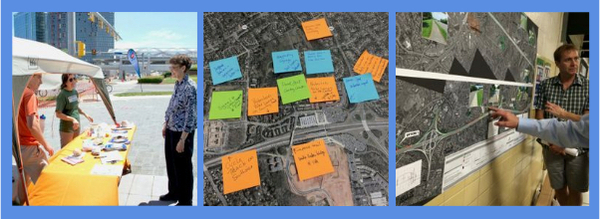
On March 15th, the Prince William County Board of County Supervisors voted to remove the Bi-County Parkway from the County’s Comprehensive Plan. Unfortunately, along with it goes one of only a few planned shared-use trail crossing of Interstate 66 (I-66). Options to replace the trail crossing in the comprehensive plan may soon be considered by the County Planning Office.

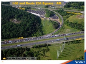
I66 - Route 234 Interchange Overview

Active Prince William supported Supervisors’ vote, as the Bi-County Parkway would have negatively impacted the protected Rural Crescent and increased truck traffic through Prince William County, while primarily benefiting Loudoun County and the Dulles Airport Authority (more background on the Bi-County Parkway). But the now-defunct Parkway did include one key benefit for Prince William residents: the plan called for a shared-use trail along its entire length, opening up a significant area for recreation to many Western Prince William County residents, and providing a key crossing of I-66, which is a significant barrier to bicylists, hikers, and walkers in the Manassas National Battlefield Park and the surrounding area. Now plans need to be updated to replace the shared-use path crossing of I-66 that was lost with the removal of the Bi-County Parkway.

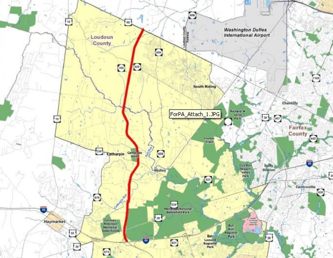
Options to replace the Bi-County shared use path crossing of I-66 may soon be considered by the County’s Planning Office as part of a technical update of the County’s trails and non-motorized transportation portions of the Comprehensive Plan, or during the Transportation Chapter update that will begin in the next year. The Prince William County Trails and Blueways Council (TBC) has discussed adding Groveton Road to the Comprehensive Plan as an I-66 crossing along with the addition of proposed bicycling improvements for Pageland Lane, a partly unpaved road that parallels I-66 West from Groveton then turns North where the Bi-County Parkway would have been built (see the map below, key: Bi-County Parkway in Red, Groveton Road in Green, and Pageland Lane in Blue).

The only existing safe crossing of I-66 along the approximately 10 mile stretch from the Fairfax County line to Route 15 is located at University Blvd (see map below). Other planned crossings are currently unsafe for people walking or biking, and include:

  • Sudley Rd (Rt 234 Business)
  • Catharpin Rd (under construction)
  • Old Carolina Rd (bridge updated)
  • Rt 15 (under construction)

VDOT has suggested 2 additional bicycle/pedestrian I-66 crossings as part of its future I-66 Outside the Beltway expansion project, under the I-66 overpass at Bull Run and at Groveton Rd. To see the full VDOT I-66 Trail plan, click here. Both of these VDOT proposed trail crossings have been discussed by the TBC, but are not currently in the PWC Comprehensive Plan.

NOTE: Even though PWC is removing the Bi-County Parkway from its Comprehensive Plan, VDOT and others still have plans for the Bi-County Parkway. So, it isn’t necessarily “dead”… yet.

Newer posts »