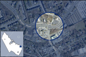
On February 3, 2022, the Prince William County Department of Transportation held a Design Public Hearing for its $11.85 million project to straighten the curve on Old Bridge Road near its intersection with Occoquan Road. Below are Active Prince William’s written comments on the proposed design of that project. View the public hearing brochure and the public hearing presentation to see the proposed design.
Active Prince William submits the following comments for the Design Public Hearing for the above-referenced project. Our all-volunteer organization seeks improved active mobility and public transportation throughout greater Prince William, to create more livable, equitable, and sustainable communities.
Our concerns with the proposed design for this intersection-reconstruction project can be summarized as follows: 1) lengthened crosswalks, 2) inadequate replacement sidewalks, 3) lack of bicycling accommodations, and 4) excessive design speeds.
Although framed as a “safety improvement”, this project does little to make walking, bicycling, or transit access safer. At the same time, this project would promote speeding and add unnecessary vehicle capacity.
According to the traffic crash reports compiled by the Virginia Department of Motor Vehicles, Prince William County experienced a total of 804 traffic crashes involving pedestrians or bicyclists during the past decade (2012-2021), resulting in 232 severe injuries and 53 deaths among people walking or bicycling. Undoubtedly, the excessive design speeds on Prince William County’s multilane arterial roadways are largely responsible for this carnage affecting people walking and bicycling, while also causing many additional deaths and severe injuries to the drivers and occupants of motor vehicles.
According to VDOT’s 2019 traffic count data, Old Bridge Road (VA 641) had an AADT of 53,000 west of Occoquan Road and an AADT of 45,000 east of Occoquan Road, whereas Occoquan Road (VA 906) had an AADT of 13,000 south of Old Bridge Road and an AADT of 2800 north of Occoquan Road. However, those traffic volumes will likely decrease once the southbound bottleneck on I-95 south of Mile-Marker 160 is fixed.
Lengthened Crosswalks
The proposed design would lengthen all three marked crosswalks at this intersection. With the added right-turn lane on eastbound Old Bridge Road, the Old Bridge Road crosswalk would become eight lanes wide. The crosswalk across the southern leg of Occoquan Road would remain six lanes wide, and the crosswalk across the northern leg of Occoquan Road would now cross four lanes of traffic, including the separated right-turn pocket from westbound Old Bridge Road.
To help mitigate the adverse impacts of those longer crosswalks, the design should create protected median pedestrian refuges in each crosswalk. In addition, whenever pedestrian crossing signals are activated, leading pedestrian intervals should be triggered to give the crossing pedestrians a head start over both right-turning and left-turning vehicles.
Moreover, serious consideration should be given to not adding right-turn lanes on eastbound Old Bridge Road and/or southbound Occoquan Road and to eliminating one or two of the existing turn lanes on northbound Occoquan Road.
On eastbound Old Bridge Road, the existing curb lane approaching Occoquan Road should be redesignated for right turns only, rather than adding a new right-turn-only lane. The VDOT traffic data show that the Old Bridge Road leg east of Occoquan Road carries 8,000 fewer vehicles/day than the Old Bridge Road leg west of Occoquan Road, indicating that two eastbound straight-through lanes are sufficient at that location.
On southbound Occoquan Road, which carries only 2800 vehicles/day, a short right-turn pocket with a pork chop island pedestrian refuge could be created as an alternative to the proposed new right-turn-only lane.
On northbound Occoquan Road, one of the two existing left-turn-only lanes could be eliminated and/or the right-turn lane replaced with a short right-turn pocket with a pork chop island pedestrian refuge.
The overall objective should be to shorten, not lengthen, the three existing crosswalks.
Inadequate Replacement Sidewalks
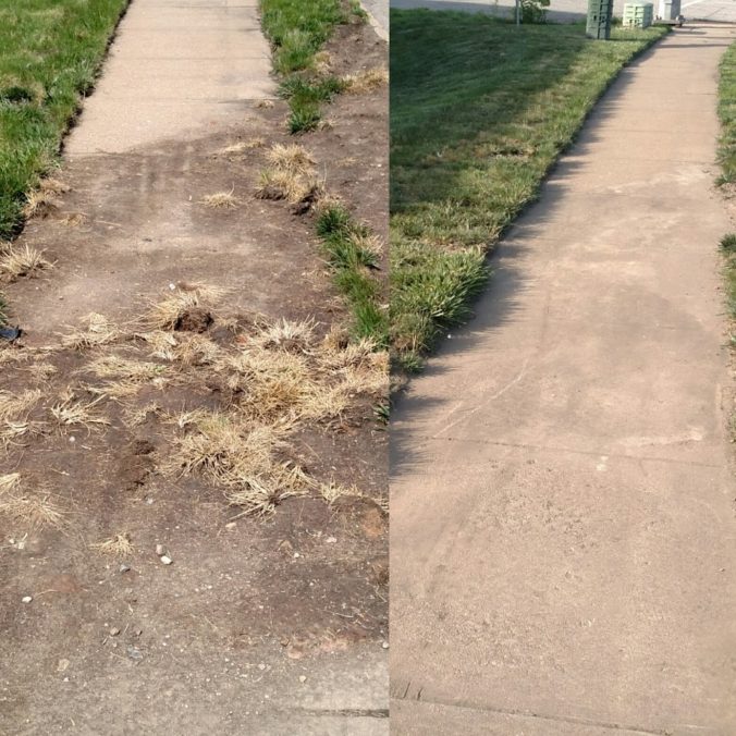
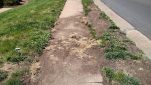
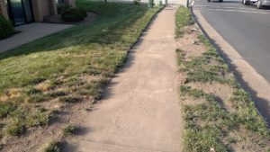
The proposed replacement sidewalks, along both sides of both roads, are only five feet wide and separated from the roadway by only a four-foot-wide grass buffer. While this does represent a modest improvement over the existing deficient sidewalks, the replacement sidewalks should be both wider and separated farther from the roadway.
Walking just four feet away from a busy multilane roadway is noisy and unpleasant, and five-foot-wide sidewalks do not comfortably accommodate two-way pedestrian traffic or walking two abreast.
Furthermore, in winter, snow and ice plowed onto such narrowly buffered sidewalks from the adjacent roadway can render such sidewalks impassable for many days and weeks. In the summer heat, the absence of street trees growing within a viable tree-planting strip makes walking without shade miserable.
In addition, the proposed sidewalks are devoid of much-needed pedestrian amenities such as benches, pedestrian-scale streetlights, and bus shelters.
The realignment of Old Bridge Road will abandon much of the existing roadway along the south side of that road. That abandoned roadway provides ample right of way to build a wider and better-separated replacement sidewalk at that location.
For future projects, the County should revise its road-design standards to provide better pedestrian accommodations.
Lack of Bicycling Accommodations
Old Bridge Road and Occoquan Road both lack bicycling accommodations, so they are not Complete Streets. Without even a sidepath (a wide sidewalk intended for both bicycling and walking), these roadways should be restriped or rebuilt with at least conventional (striped) on-road bicycle lanes.
Besides improving bicycling conditions, conventional on-road bicycle lanes enhance the pedestrian environment by increasing the separation between the sidewalk and vehicle traffic and by shortening pedestrian crossings of the vehicle lanes at intersections.
Old Bridge Road has overly wide 12-foot travel lanes, the width used on Interstate highways with 70+ MPH design speeds. Thus, bike lanes could easily be retrofitted on Old Bridge Road at any time, simply by restriping its six 12-foot-wide travel lanes as six 11-foot-wide travel lanes and reallocating the freed-up space for bike lanes. When added to the existing two-foot-wide concrete gutter pans, the freed-up space would produce five-foot-wide bicycle lanes, meeting the AASHTO minimum width. Some additional space for bike lanes (or wider medians) could be created by narrowing all left- and right-turn lanes to 11 feet as well.
Since Occoquan Road has only 11-foot lanes, narrowing those lanes to create bike lanes—while still somewhat feasible—might not be approved by VDOT. However, it is readily feasible to modify the current project to redesign the rebuilt north leg of Occoquan Road to incorporate five-foot bike lanes in both directions.
The south leg of Occoquan Road has at least four travel lanes between Old Bridge Road and US-1 yet had an AADT of only 13,000 in 2019. This roadway is thus a prime candidate for a four-lane to three-lane road diet, producing a roadway with only one travel lane per direction, a two-way left-turn lane in the center, and two one-way bicycle lanes.
Such roadway reconfigurations, if managed by VDOT during scheduled roadway resurfacing, are highly cost effective and are accomplished at no cost of the County. Prince William County should coordinate with VDOT to retrofit bike lanes on the entirety of Old Bridge Road and of Occoquan Road whenever those roadways are next scheduled for periodic resurfacing. If either roadway is reconfigured before the current project is completed, the current project should ensure that those bike lanes are incorporated into the final roadway striping plan for the rebuilt segment.
Excessive Roadway Design Speeds
At the public hearing, project staff reported that the proposed design would preserve the present 35 MPH posted speed limit on Old Bridge Road and aims for a 40 MPH design speed. Those speeds are too high for an arterial roadway through a commercial corridor with nearby residential neighborhoods and a large park-and-ride facility.
Project staff also noted the traditional highway engineering practice of posting speed limits based on the observed speeds of the motorists that use the roadway (i.e., the 85th percentile speed). Such an antiquated and dangerous practice is the opposite of a safe systems approach; namely, engineers should select roadway design speeds and standards that allow pedestrians and bicyclists to survive most collisions with motor vehicles.
Narrowing the lanes on Old Bridge Road to 11 feet (or less) would be one simple step to reduce the excessive design speed on this roadway. In addition, the curb-return radii at all corners of this intersection should be reduced to conform to the 30 MPH design speed that is appropriate for this roadway.
Thank you for considering our comments as you finalize the design of this project.
Sincerely,
Allen Muchnick and Mark Scheufler, co-chairs Active Prince William
###

